
Clay County proposed redistricting map
Electoral boundaries are redrawn every ten years following the completion of the Census to account for changes in population during the previous decade.
The federal government requires that …
This item is available in full to subscribers.
Attention subscribers
To continue reading, you will need to either log in to your subscriber account, below, or purchase a new subscription.
Please log in to continueDon't have an ID?Print subscribersIf you're a print subscriber, but do not yet have an online account, click here to create one. Non-subscribersClick here to see your options for subscribing. Single day passYou also have the option of purchasing 24 hours of access, for $1.00. Click here to purchase a single day pass. |
Clay County proposed redistricting map
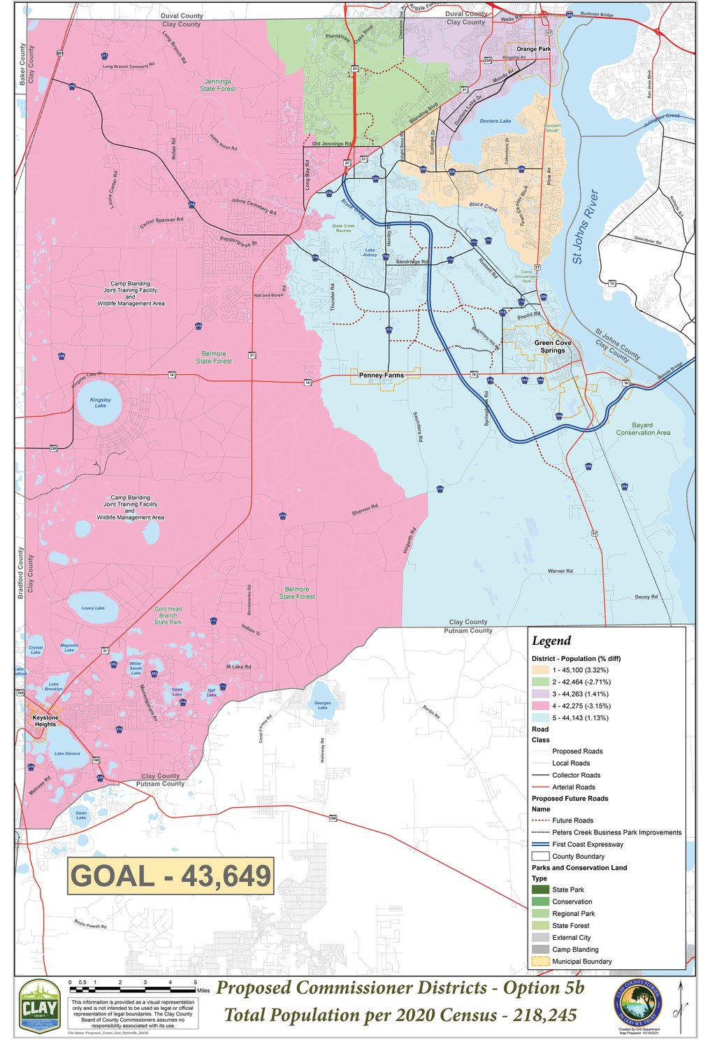


Electoral boundaries are redrawn every ten years following the completion of the Census to account for changes in population during the previous decade.
The federal government requires that districts must have nearly equal populations and must not discriminate on the basis of race or ethnicity.
The redistricting state-based requirements are located here: https://ballotpedia.org/Redistricting.
Community feedback is encouraged and comments may be submitted to the Board of County Commissioners be emailing troy.nagle@claycountygov.com.
The proposed map is also located here: https://www.claycountygov.com/government/redistricting.”
![]()
get social